Ana Maria
LOCATION
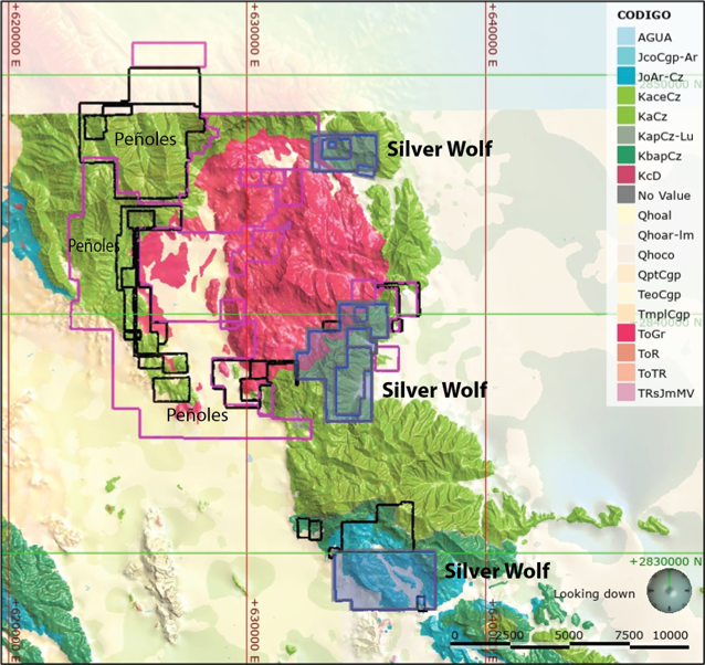
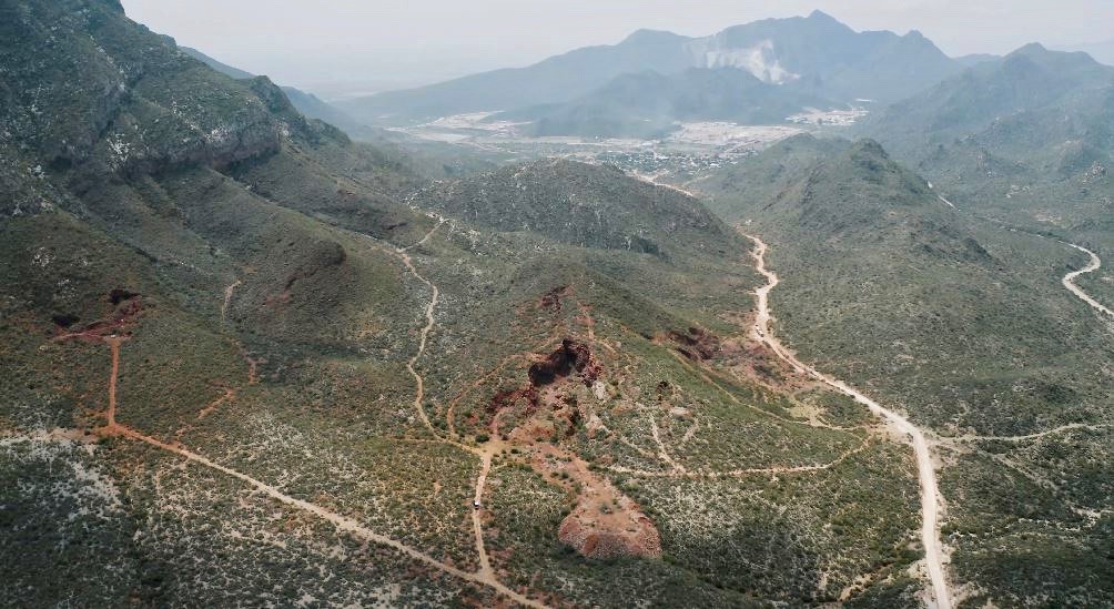
The Ana Maria property is located 21 kilometres (km) northwest of the City of Gómez Palacio and the adjacent City of Torreón, and 1 km north of the town of Dinamita, in the municipality of Gómez Palacio, Durango, Mexico. The claims are located in the Minitas mining district in the Guadalupe Victoria mining region. The property consists of 9 mining concessions encompassing 2,549 hectares (ha).
ABOUT ANA MARIA
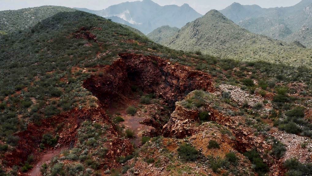
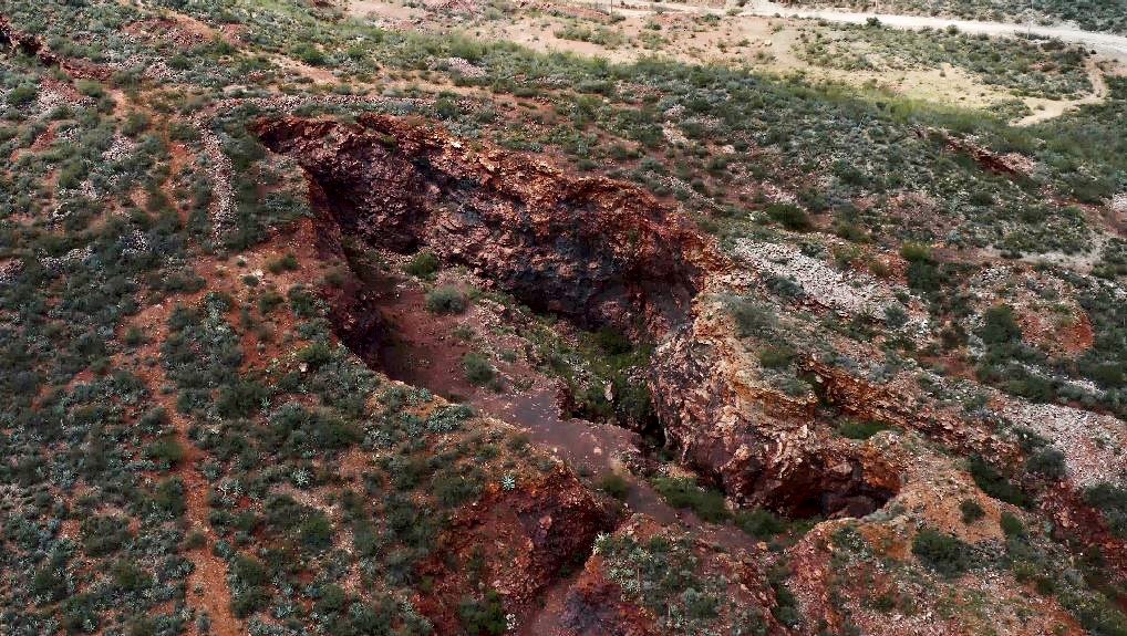
Minimal documentation exists regarding the history and production at Ana Maria; however, historical reporting states that La Lucha was exploited for Iron (Fe) and Manganese (Mn). Production terminated in 1943 and it was estimated to have produced 12,000 tons of material and reserves of approximately 25,000 tons.
The historical estimates of production and reserves as stated above are for historical reference only and do not use the categories set out in NI 43-101. The estimates are deemed relevant from the perspective that mineralization is present on the property which may indicate the existence of other related mineral assemblages. The QP has not validated nor verified these historical estimates nor any underlying data as information and data is not available. The QP has not done sufficient work to classify the estimates and the issuer is not treating the historical estimate as current. The source of the information is the Mexican Government website and USGS (United States Geological Survey) website.
These projects are located in the North West-South East (NW-SE) striking fold-thrust belt of the Sierra Madre Oriental within a west trending prong known as the Sierras Transversales or the Monterrey-Torreón transverse system. It divides the Mesa Central, an elevated plateau to the South, from the eastern Mexican Basin and Range to the North.
The region hosts a number of carbonate replacement deposits (CRD´s) within Cretaceous limestones and dolomites. Mineralization is associated with large stocks, dykes or sills of granitoids ranging from diorites to quartz monzonites and rhyolites and inferred to be lower crustal in origin. Mineralization is present as skarns or massive sulphides and occurred during Mid-Tertiary volcanism when the aforementioned intrusions were emplaced (Megaw et al., 1988 and references therein). The deposits typically produce silver, lead, zinc and copper although some districts, such as Ojuela (~10 kilometres from Ana Maria and La Zorra), are enriched in gold relative to typical CRD´s1.
INAUGURAL DRILL PROGRAM
On September 3, 2024 Silver Wolf announced the commencement of drilling on the El Soldado Claim at the Ana Maria Project.
Over the last few months, the team has been integrating additional data into the geological model and drill plan, which has resulted in improved drill targets and a refined proposed drill program at El Soldado. The El Soldado Claim is the primary target at the Ana Maria Property and is interpreted to be a carbonate replacement deposit (CRD)-style target.
The number of planned drill holes has increased to fifteen (15) for a 2,500-metre drill budget. Two drill rigs will be utilized for the drill program and will be mainly testing targets by drilling 120-230 meters long, HQ diameter, diamond drill holes along the NW-SE prospective trend where the various historical workings and mineral occurrences have shown significant precious and base metal mineralization from surface sampling. The drill planning will also use geological deposit modelling and target classic CRD alteration and brecciated carbonate host rock features.
In addition, two (2) optional holes have been laid out with planned depths of 200-250 meters to test the SE continuation of the mineralization trend, in case the preliminary results of the previous holes justify deeper target testing. The proposed drill program is subject to changes as the program progresses, and can lead to changes in number, location, depth and orientation of the drilled holes.
See press release Silver Wolf Announces Start of Inaugural Drill Program at the Ana Maria Project dated: September 3, 2024
1.Please note that neighboring properties deposits do not necessarily apply to the current project or property being disclosed